Subject: Yellowstone, Wyoming
Period: 1898-1900 (circa)
Publication:
Color: Printed Color
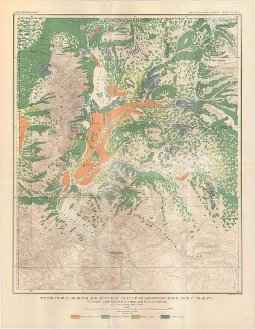
A. Teton Forest Reserve and Southern Part of Yellowstone Park Forest Reserve Showing Land Classification and Wooded Areas, by T.S. Brandegee, dated 1898 (14.4 x 17.5"). This map, showing Jackson Hole and Jackson Lake, was produced just one year after the establishment of the Teton Forest Reserve. A legend at bottom identifies four different land classifications. Condition: Issued folding with vivid color. (A)
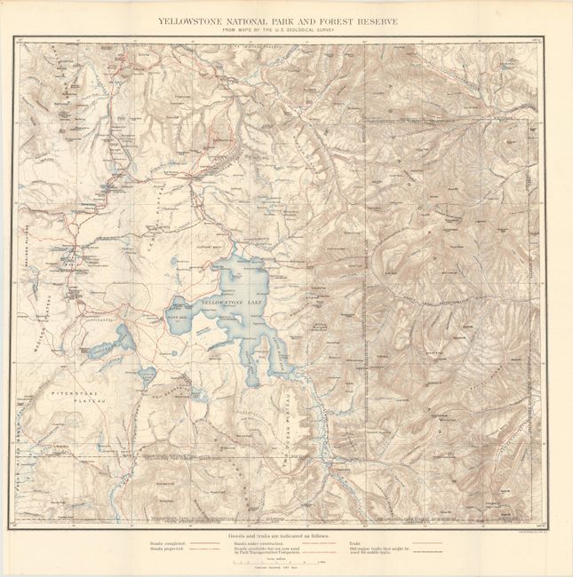
B. Yellowstone National Park and Forest Reserve, by U. S. Geological Survey, circa 1900 (19.4 x 18.5"). This finely detailed topographical map shows all of Yellowstone Park plus the region to the east up to Bighorn County, in today's Park County. It has good topographical detail with contour intervals at 100 feet at a scale of 1 inch = 4 miles. The Upper, Shoshone, Gibbon, and Heart Lake Geyser Basins are named, along with the Mud Geysers, Mammoth Hot Springs and Old Faithful Hotel. Condition: Issued folding on a clean sheet.
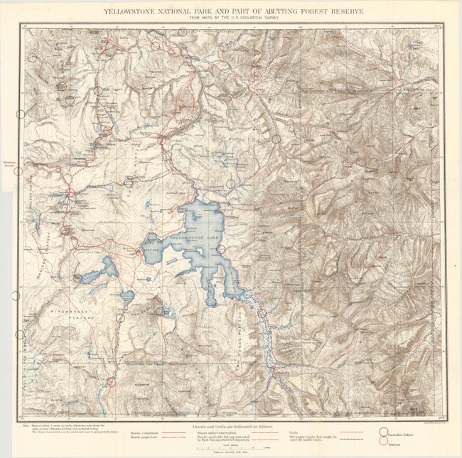
C. Yellowstone National Park and Part of Abutting Forest Reserve from Maps by the U.S. Geological Survey, by Julius Bien & Co., circa 1900 (19.8 x 18.5"). Similar map as above with the addition of cabins and ranger stations showed in black and red overprinting. Condition: Issued folding with a binding trim at left.
References:
Condition: A
See description above.