Catalog Archive
Auction 147, Lot 245

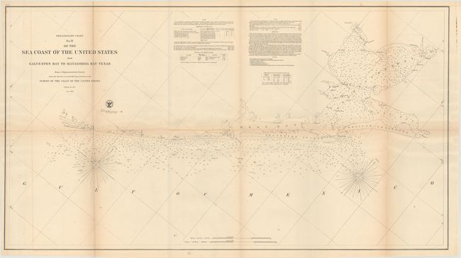
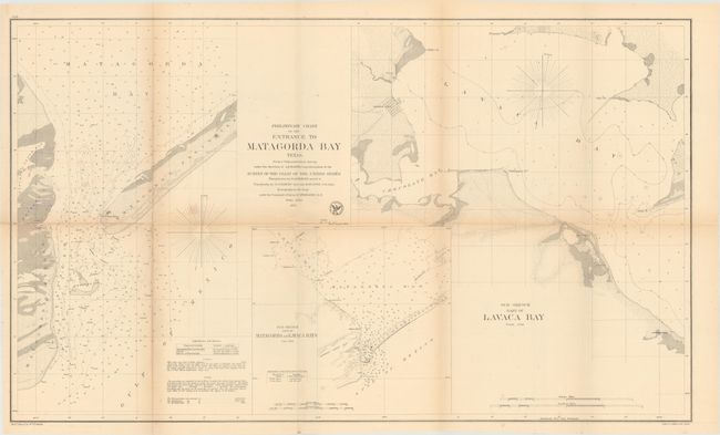
"[Lot of 2] Preliminary Chart No. 31 of the Sea Coast of the United States from Galveston Bay to Matagorda Bay Texas [and] Preliminary Chart of the Entrance to Matagorda Bay Texas", U.S. Coast & Geodetic Survey

Subject: Texas

Period: 1857 (dated)

Publication:

Color: Black & White

Size:
See Description
Download High Resolution Image
(or just click on image to launch the Zoom viewer)

These two charts of the Texas coastline cover Galveston Bay and Matagorda Bay and are filled with information for the mariner including soundings, magnetic variation, and detailed navigational notes. Produced by the U.S. Coast Survey under the direction of A.D. Bache.

A. Preliminary Chart No. 31 of the Sea Coast of the United States from Galveston Bay to Matagorda Bay Texas (36.3 x 20.3").

B. Preliminary Chart of the Entrance to Matagorda Bay Texas (32.0 x 19.3").

References:

Condition: B

Issued folding with light toning and offsetting and a few short splits closed on verso with archival tape.

Estimate: $120 - $150

Sold for: $130

Closed on 11/20/2013

Archived