Subject: South Carolina
Period: 1795-1812 (circa)
Publication:
Color: Hand Color
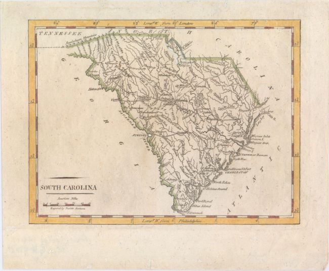
A. South Carolina, by Mathew Carey, from American Pocket Atlas, circa 1801 (7.6 x 5.8"). A delicately engraved map that details topographical features, watershed, towns and villages, and the road network. Locates Four Holes Swamp north of Charleston. The distance scale is in American Miles. This is the second state with roads and additional place names. Engraved by Doolittle. Condition: This example has nice margins with a few tiny wormholes that are not visible unless held up to light. Two long pieces of archival tape run across verso at top and bottom, closing a few short tears, well away from image. (A)
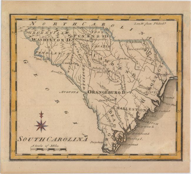
B. South Carolina, by Joseph Scott, circa 1795 (7.3 x 6.2"). A sharply engraved and early American map in its second state. This example shows numerous rivers and mountains and locates Charleston, Bull Island, Columbia, Hilton Head, and many others. Condition: A dark impression, backed in linen, and remargined at top and bottom with part of the neatline appearing in facsimile. There is also minor soiling. (B+)
References: Wheat & Brun #602-03.
Condition:
See description above.