Subject: World
Period: 1687 (circa)
Publication: Relationes Curiousae…
Color: Black & White
Size:
11.4 x 8 inches
29 x 20.3 cm
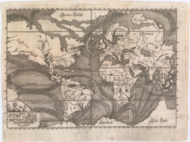
This is one of the earliest thematic maps of the world. The ocean currents are graphically depicted and although conjectural, the map is the first serious attempt to portray scientific phenomena based on the reported findings of seamen. Four curious tracks, perhaps denoting subterranean tunnels, link the Black and Caspian Seas, the Caspian Sea with the Persian Gulf, the Mediterranean with the Red Sea, and most interestingly the Atlantic with the Pacific through the Isthmus of Panama. The landmasses are marked with the locations of live volcanoes. Noted as scarce by Shirley.
References: Shirley #468; Robinson, p. 46-47.
Condition: B
Issued folding with light soiling and several separations and tiny holes along the bottom horizontal fold that have been archivally repaired, with a small amount of image in facsimile. An edge tear at left that enters 1.5" into the image has also been archivally repaired.