Subject: Massachusetts, Rhode Island
Period: 1796 (published)
Publication: The American Universal Geography
Color: Hand Color
Size:
9.8 x 7.5 inches
24.9 x 19.1 cm
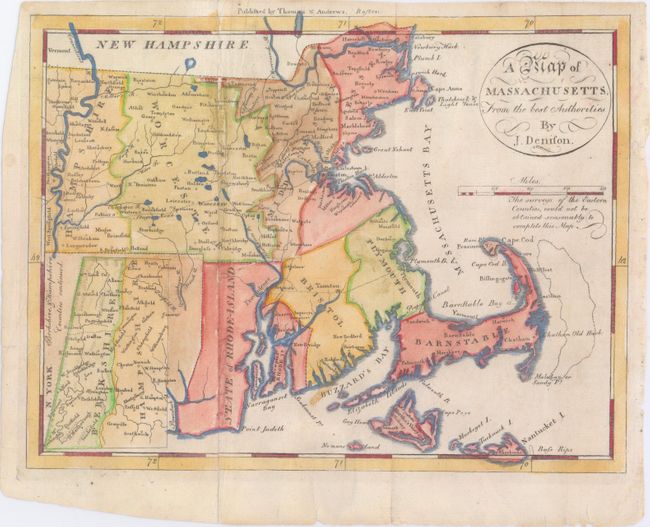
This scarce edition is from the third edition of Morse's Geography. The counties are named and delineated both in engraved line and color. The bank offshore from Cape Cod is located. The western counties of Hampshire and Berkshire are continued in an inset at lower left. The map also shows towns, roads, topography and good watershed detail. The Proposed Canal is located near Sandwich. Beneath the oval title cartouche and distance scale is the note "The surveys of the Eastern Counties, could not be obtained reasonably to complete this Map." As a result the counties of Bristol, Plymouth, and Barnstable are mostly blank. The imprint of publishers Thomas & Andrews is across the top above the neatline. In tiny letters below J. Denison the engraver is given as "S.H." which Wheat & Brun attribute to Samuel Hill.
References: Wheat & Brun #218.
Condition: B+
This has been professionally restored along one fold, and there are some short tears and fold separations, mostly confined to the blank margins, with one 1" tear entering the neatline near the title cartouche that has been closed on verso with archival tape.