Subject: Kentucky
Period: 1822 (circa)
Publication:
Color: Hand Color
Size:
18.5 x 11.3 inches
47 x 28.7 cm
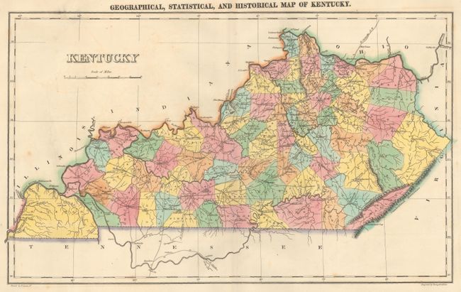
The map is on a full folio sheet (22 x 17.3") with English text below giving a brief description of Kentucky's boundaries, productions, rivers, climate, chief towns, manufactures, commerce, education, and religion. The finely engraved map delineate and hand colors counties with their organization current to 1821. Kentucky and Tennessee are almost always shown on the same map, so it is uncommon to find Kentucky alone. The cleanly engraved map details the roads, towns and settlements, rivers and political divisions. Very finely engraved by Young & Delleker.
References:
Condition: B+
Nice impression on a clean sheet with a few minor spots and a short centerfold separation at top that just passes the neatline.