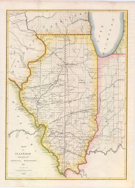
Subject: Illinois
Period: 1836 (dated)
Publication:
Color: Hand Color
Size:
12.5 x 17.5 inches
31.8 x 44.5 cm
This detailed map provides information on the counties, watershed, settlements, Indian villages and railroads. The proposed routes of the Illinois Central Railroad, Alton and Mount Carmel Railroad, Hillsboro Rail Road, Northern Cross Rail Road, and the Warsaw and Peoria Rail Road are shown. The Indian land boundary and the area ceded to the U.S. by the Sioux, Sac, and Fox nations are noted. Burr was a commercial cartographer and publisher of some note, in addition to being the Topographer to the Post Office and the Geographer to the House of Representatives.
References: Claussen & Friis #146.
Condition: A
Clean and bright example. Issued folding and now flattened.