Catalog Archive
Auction 147, Lot 204

"Economic Geology Colorado Cripple Creek Special Map to Accompany the Sixteenth Annual Report, Part II", U.S. Geological Survey (USGS)

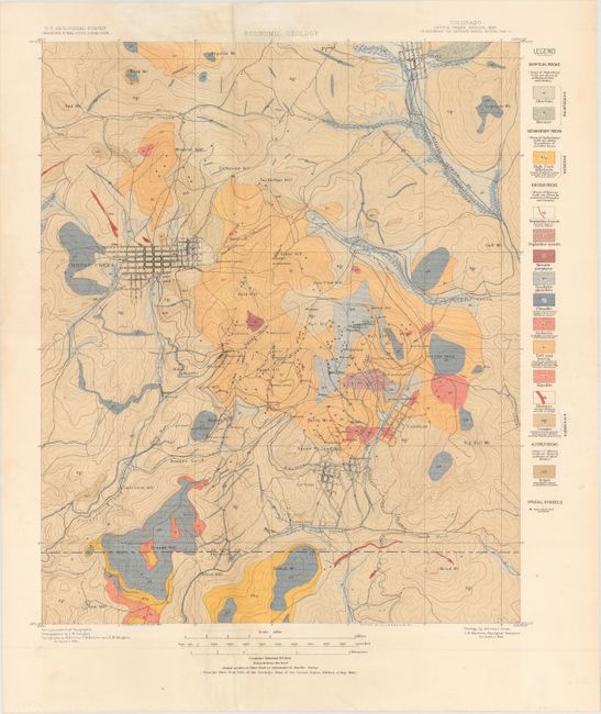
Subject: Central Colorado, Gold Mines

Period: 1895 (dated)

Publication: Sixteenth Annual Report

Color: Printed Color

Size:
16.1 x 19.6 inches
40.9 x 49.8 cm
Download High Resolution Image
(or just click on image to launch the Zoom viewer)

This striking topographic map from a 1894 USGS survey shows the mining town (and former ghost town) Cripple Creek and its surroundings in what is today Teller County. Several mountains, gulches, and hills are named, and a few towns appear in grid-like plans, including Victor and Cripple Creek itself. A legend to the right of the map explains the corresponding rock type for each color and pattern combination on the map. The map is also freckled with several small stars that represent various gold mines and prospects. Produced under the direction of Charles D. Walcott.

References:

Condition: A

Issued folding, now pressed flat, with a fold separation at top that has been closed on verso with Japanese tissue and a few minor spots, mostly in the blank margins.

Estimate: $100 - $140

Sold for: $75

Closed on 11/20/2013

Archived