Subject: Alaska, British Columbia
Period: 1964 (dated)
Publication:
Color: Printed Color
Size:
42.9 x 31.6 inches
109 x 80.3 cm
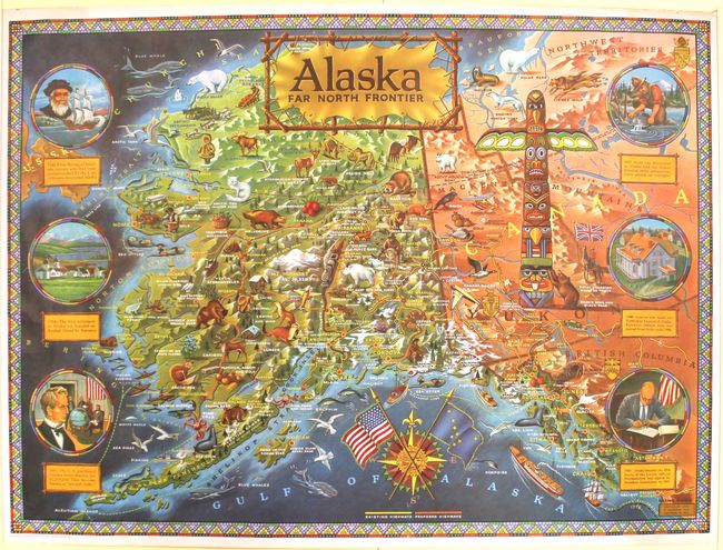
This is the second edition of this appealing and graphic map originally published in 1959 to celebrate Alaska's statehood. In addition to the topography, cities, rivers, lakes, mountains, and existing and proposed highways of Alaska and western Canada, the map is teeming with illustrations of the wildlife of the region (including sea otters, timber wolves, and grizzly bears), several prospectors, bush planes, a train, a "Mountie", a massive totem pole, and various other local phenomena. Six circular vignettes run along the left and right sides of the map, depicting moments from the state's history, including Vitus Bering's discovery of the area, Seward's Folly, and President Eisenhower signing Alaska into statehood. The title of the map appears on a stretched piece of animal hide and a compass rose at bottom features the American flag crossed with Alaska's state flag. Surrounded by a beadwork-style border. Illustrated and published by R. Klengston "Kleng" Rude.
References:
Condition: A
A few extraneous creases and some short tears in the blank margins.