Subject: Alaska
Period: 1890-1904 (circa)
Publication:
Color: Printed Color
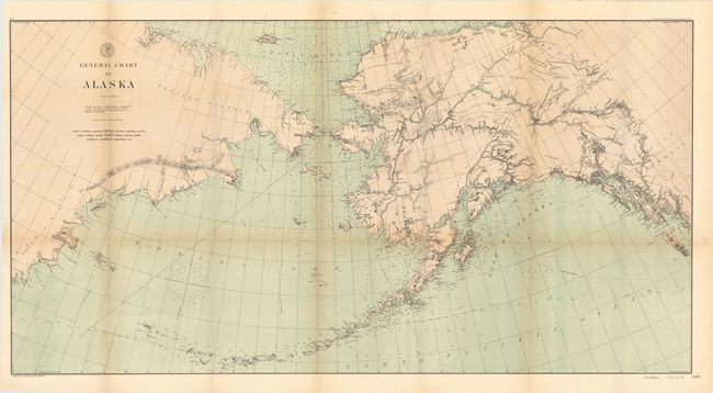
A. General Chart of Alaska, by the U.S. Coast and Geodetic Survey, dated 1890 (49.6 x 26.0"). Very detailed chart with particular emphasis on the coast and Aleutian Islands including hundreds of soundings. There is good detail of the interior, considering the date of the map, with forts and numerous Indian villages. The map includes a large section of the Russian coastline. Two sheets joined and folded, as issued. Condition: Several short splits at fold intersections and moderate toning along the folds. (B)
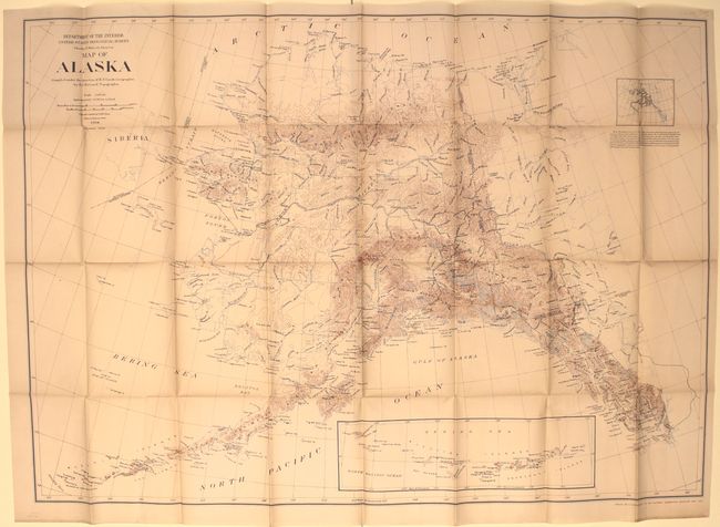
B. Map of Alaska, by the Department of the Interior, dated 1904 (47.0 x 32.9"). This detailed map shows the topography and watershed based upon the U.S. Geological Survey as well as the U.S. Coast and Geodetic Survey. An inset at bottom depicts the Aleutian Islands. Issued as a supplement to the May 1904 National Geographic magazine. Condition: Issued folding with light toning along a few folds and a few short splits at fold intersections. (B+)
References:
Condition:
See descriptions above.