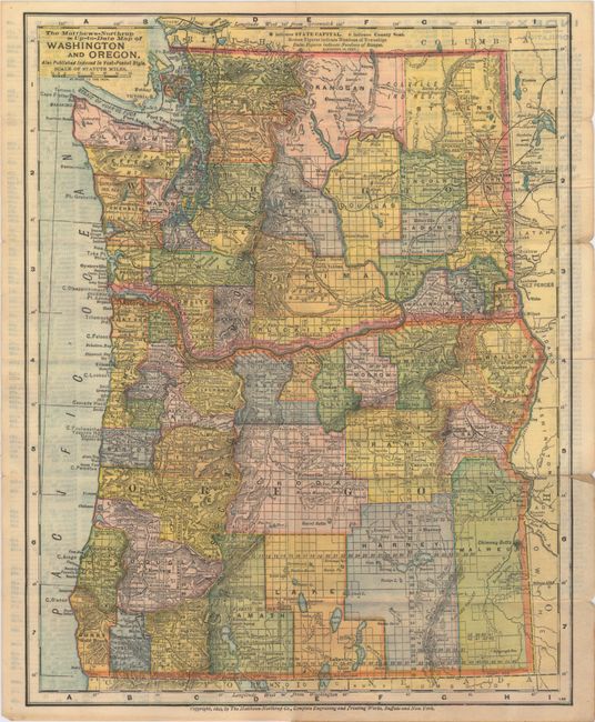
Subject: Northwestern United States
Period: 1893 (circa)
Publication:
Color: Printed Color
Size:
9.5 x 12 inches
24.1 x 30.5 cm
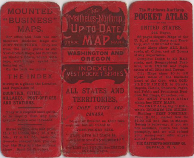
This is an uncommon vest-pocket map produced by the same company that created the Century Atlases in the period 1897-1905, with the same remarkably precise engraving and coloring style. It shows the counties, topography, roads, railroads, cities, towns and the progress of the public surveys. A full index appears on the verso. The map folds into small red, embossed paper covers (2.2 x 5.3") as an "Up-to-Date Map" noting this is part of the "indexed vest-pocket series." This was part of Matthew-Northrup's attempt to compete with Rand, McNally's vest pocket series. Evidently the project was not a commercial success, as these maps are very scarce today.
References:
Condition: B+
Map is very good with a few short splits at fold intersections and along sheet edges, as well as faint show-through of text on verso. Covers are lightly worn and the back cover is partially separated.