Subject: Central United States
Period: 1873 (circa)
Publication:
Color: Hand Color
Size:
12.7 x 14.6 inches
32.3 x 37.1 cm
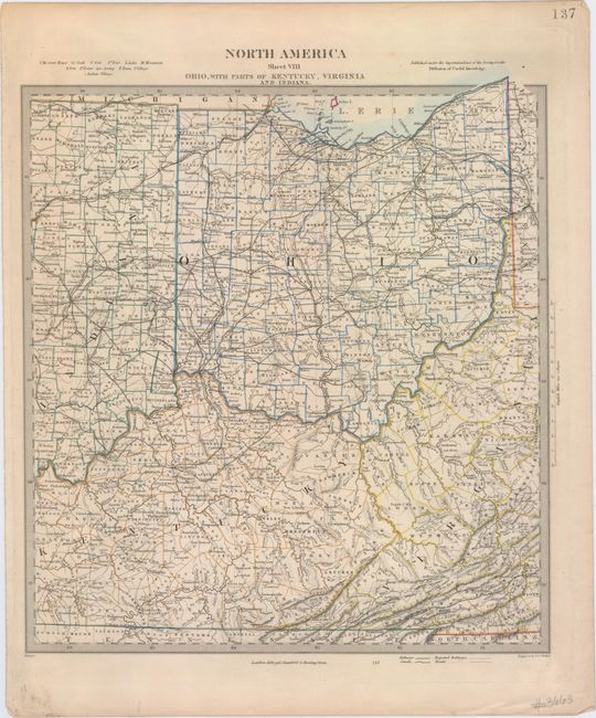
The beginning of the nineteenth century saw a period of rapid market growth and innovation in the map publishing world. Increased literacy and public interest in new frontiers and colonies overwhelmed the market because it was oriented toward the small, affluent market of the previous century. With the intent to fill this void, The Society for the Diffusion of Useful Knowledge (SDUK) was founded in 1828 in London, by Lord Brougham and a group of men dedicated to the education of the aspiring working class and the Utilitarian ideal of 'Knowledge is Power.' The society produced an array of education materials, but the series of maps was one of their most successful ventures. A number of engravers and printers were used to produce the maps, which eventually exceed 200 sheets, and continued to be published after the Society as a whole ceased to function.
This map covers all of Ohio and portions of Kentucky, Virginia, West Virginia and Indiana. The National Road is clearly depicted between Springfield, Ohio and Indianapolis. Presents good detail of county lines, villages, courthouses, canals, railways, and roads throughout the area with topographical and watershed detail. Published by Edward Stanford at 6 Charing Cross.
References:
Condition: A
Minor soiling confined to the blank margins.