Subject: Central United States
Period: 1839 (dated)
Publication: Smith's Geography for Schools
Color: Hand Color
Size:
17.6 x 10.5 inches
44.7 x 26.7 cm
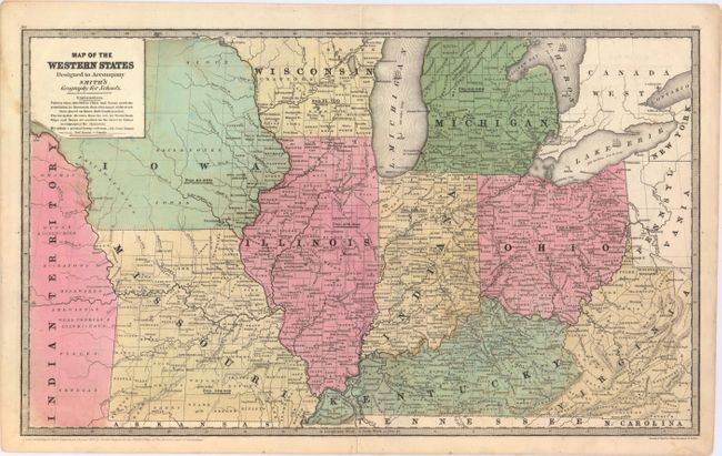
This finely engraved map shows the states of Missouri, Illinois, Indiana, and Ohio, with parts of Iowa Territory, Wisconsin Territory, Kentucky, Michigan and Virginia. The detail is excellent with all counties named and hundreds of towns and villages depicted. Delineates the National Road to the Mississippi River. The legend indicates court houses, capitals, railways and canals. Dated at lower left, "Entered according to Act of Congress in the year 1839 by Daniel Burgess in the Clerk's Office of the District Court of Connecticut."
References:
Condition: B+
A mostly clean sheet with some faint offsetting, minor soiling, and a short centerfold separation at bottom that has been closed on verso with archival tape.