Catalog Archive
Auction 147, Lot 176

"A Map of the State of Kentucky and the Tennessee Government Compiled from the Best Authorities by Cyrus Harris", Morse, Jedidiah (Rev.)

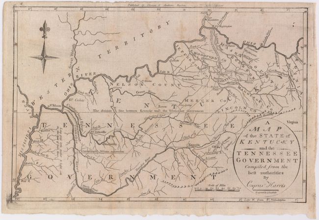
Subject: Tennessee, Kentucky

Period: 1797 (circa)

Publication: Morse's Universal Geography

Color: Black & White

Size:
11.5 x 7.5 inches
29.2 x 19.1 cm
Download High Resolution Image
(or just click on image to launch the Zoom viewer)

This very early map shows some topographical features, villages and a few roads. The "New & Short Road" to Virginia crosses the Big Sandy River at Vancouver. It names Clarksville, Nashville, Lexington, Bards Town, Harrods Town, Danville, the Forts Hamilton, Washington, Massac and the Harmons Station. Published by Thomas & Andrews, Boston, and engraved by Amos Doolittle. Title is in a simple oval shaped cartouche.

References: Wheat & Brun #645.

Condition: B

Issued folding, now pressed with light offsetting and a few minor stains in the image.

Estimate: $350 - $425

Sold for: $250

Closed on 11/20/2013

Archived