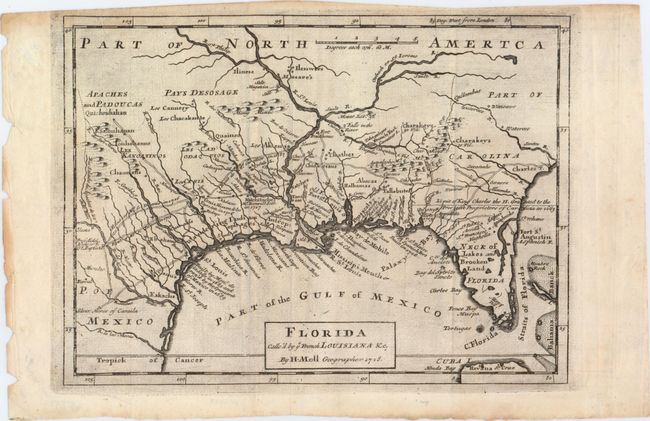
Subject: Colonial Southern United States
Period: 1728 (dated)
Publication: Atlas Minor
Color: Black & White
Size:
10.7 x 7.8 inches
27.2 x 19.8 cm
This map is based on Moll's larger map of 1720 and portrays the Gulf Coast and Florida with detail of Indian villages, missions, mines, and forts. It is one of the earliest printed maps to describe the roads and trading paths in the region. It is also filled with interesting notations including notes on La Salle's landing in Texas in 1685, the Cenis Missions and early Texas settlements in 1716-17, and the limits of King Charles II's Grant to the Lord Proprietors (Carolina) in 1663. This is the first state with the erroneous apostrophe in calle'd in the title and the date.
References: Cumming (SE) #201, Phillips (A) #574.
Condition: B+
A slightly uneven impression, issued folding, with some printer's ink residue.