Catalog Archive
Auction 147, Lot 165

"Carte de la Nouvelle Georgie", Bellin, Jacques Nicolas

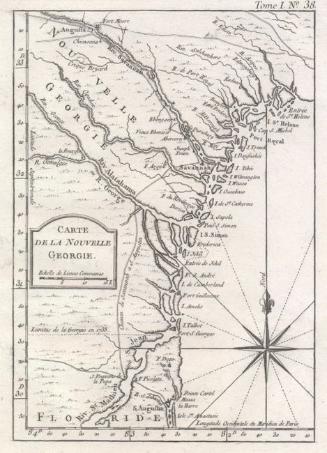
Subject: Colonial Southeast

Period: 1764 (published)

Publication: Le Petit Atlas Maritime

Color: Black & White

Size:
5.9 x 8.4 inches
15 x 21.3 cm
Download High Resolution Image
(or just click on image to launch the Zoom viewer)

This uncommon small map depicts the coastline from St. Augustine to St. Helena Sound and inland as far as Augusta. The boundary between Georgia and Florida is shown as of 1738. There are only a few settlements and one road connecting Augusta, Savannah, and St. Augustine. Simple title block and fine fleur-de-lis topped compass rose are the only embellishments.

References: Cumming (SE) #344; Phillips (A) #3508-38; Tooley (MCC-96) #849.

Condition: A

A nice impression with generous margins and a slight amount of printer's ink residue.

Estimate: $450 - $550

Sold for: $295

Closed on 11/20/2013

Archived