Subject: Colonial Southeast
Period: 1757 (dated)
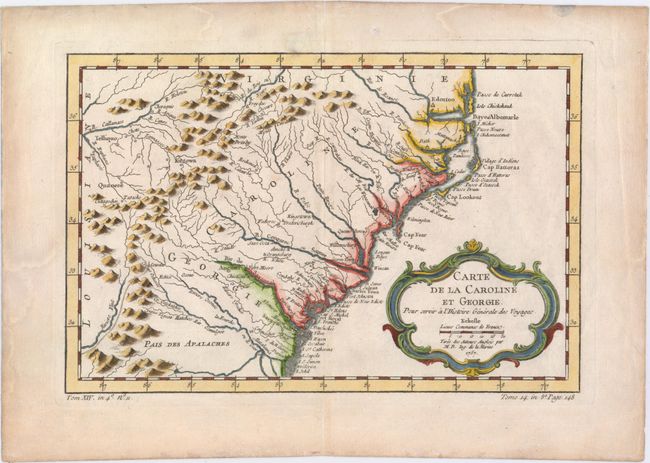
Publication: Prevost's Histoire Generale des Voyages
Color: Hand Color
Size:
11.3 x 7.4 inches
28.7 x 18.8 cm
Delicately engraved map of the colonies of Carolina and Georgia from Albemarle Sound to the Alatamaha River. It probably owes its origin to the 1752 map of the region by Emanuel Bowen. There are numerous English settlements along the coast and Indian villages are located throughout, including a number west of the Appalachian Mountains. There is more detail in the area west of the Blue Ridge than in many other maps of the period. It shows a rudimentary course of the Tennessee River in the northwestern section of the map. A decorative rococo-style title cartouche incorporates the distance scale.
References: Cumming (SE) #311; Sellers & van Ee #1384.
Condition: A
A fine impression on watermarked paper with good margins. There are minor damp stains confined to blank margins, and a small hole in top blank margin that has been professionally repaired.