Subject: Mid-Atlantic United States, Maryland & Delaware
Period: 1846 (dated)
Publication: New Universal Atlas
Color: Hand Color
Size:
14.3 x 11.3 inches
36.3 x 28.7 cm
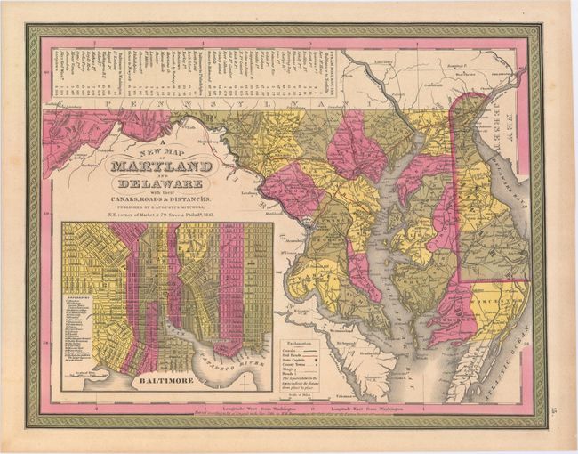
This is the rare Burroughs edition of this attractive map that carries nice detail of the counties, cities, roads and railways. A large inset of Baltimore includes a key to significant buildings. Across the top of the map is a table of Steam Boat Routes - from Baltimore to Norfolk, Baltimore to Philadelphia, and Baltimore to Washington with total and incremental mileage between stops. Mitchell obtained Tanner's entire business and the production facilities and plates for Tanner's New Universal Atlas. He first printed it under his name in 1846, retaining Tanner's copyright notice on most of the maps. A second 1846 edition was then published using the imprint H.N. Burroughs. Nothing is known about Burroughs, but Ristow surmises he may have been an employee or associate of Mitchell's.
References: Ristow, p. 311.
Condition: A
Original color with a hint of toning.