Subject: Delaware & Chesapeake Bays
Period: 1841-54 (circa)
Publication: American Coast Pilot
Color: Hand Color
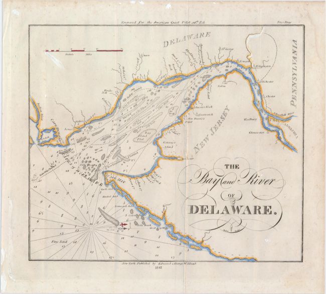
A. The Bay and River of Delaware, dated 1841 (8.5 x 7.4"). This chart of the Delaware Bay comes from the 14th edition of The American Coast Pilot, published by Edmund and George W. Blunt. It shows soundings, rhumb lines, and various channels, flats, capes, inlets, beaches, and smaller waterways that branch off from the Delaware River. Philadelphia appears on the right of the map, as do many towns and cities in Delaware and New Jersey that border the bay. The north is oriented to the right. Engraved by Hooker. Condition: Issued folding with some faint spots, slightly uneven impression at bottom, and a damp stain along the right edge, well away from image. (B)
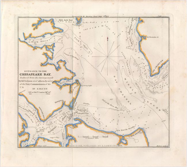
B. Entrance to the Chesapeake Bay. Reduced from the Surveys Made by D.P. Adams and Others by Order of the Navy Commissioners of the U.S., dated 1854 (8.4 x 7.2"). Engraved for the 17th edition of The American Coast Pilot, published by E. & G.W. Blunt, this chart details the southern portion of Chesapeake Bay around Hampton. It extends north to show Mob Jack Bay and Old Plantation Flats. Shows Cape Charles, Cape Henry and its lighthouse, Lyn-Haven and Hampton Roads, the York Spit, Back River and more. Locates the James, Back, and York Rivers. Soundings and shoals are located, such as the Tail of the Horse Shoe. Engraved by Hooker. Condition: Issued folding with a few minor spots and a printer's crease entering the neatline at left. (A)
References:
Condition:
See description above.