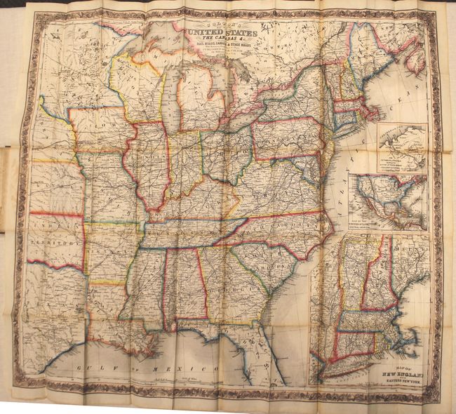
Subject: Eastern United States
Period: 1855 (dated)
Publication:
Color: Hand Color
Size:
28.5 x 26.3 inches
72.4 x 66.8 cm
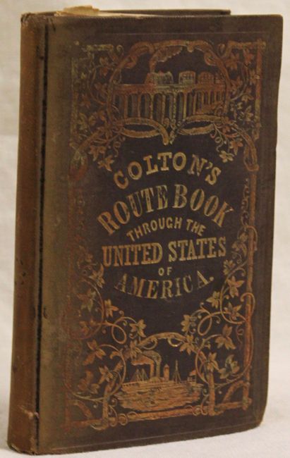
This very large folding map offers an exceedingly detailed view of the eastern United States up to the Great Plains. Printed on fine bank note paper, the map extends to show part of Texas, Indian Territory, and a large Minnesota. In the south, the map extends in Florida to only about half of Lake Okeechobee, or about 60 miles south of Tampa. The map is filled with place names, roads, rail roads and rivers. A large inset (8.5 x 19.5") gives more detail to New England and eastern New York. Another inset shows all of the U.S. in a post-Gadsden Purchase configuration. A third, smaller inset details the Isthmus of Panama. All surrounded by a decorative floral and grapevine border. The map is still attached to the original brown cloth-covered boards with embossed covers, gilt title and 166pp. of text.
References:
Condition: C+
Issued folding with vivid original outline color. There are numerous splits and chips at fold intersections resulting in small loss of image with some toning along the folds. The text is in very good condition with light, scattered foxing. Covers are worn and sunned.