Subject: Eastern United States
Period: 1828 (dated)
Publication:
Color: Hand Color
Size:
20.3 x 16.1 inches
51.6 x 40.9 cm
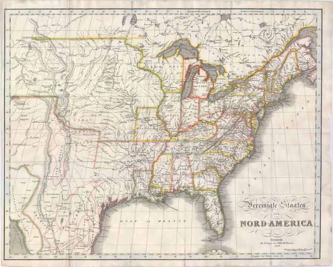
This is an uncommon German edition of Melish’s important map, depicting the United States from the eastern seaboard west to the Rockies and a portion of the Great Basin. The Northwest Territory occupies the area that would become Wisconsin and a portion of the Upper Peninsula of Michigan and Minnesota. Missouri is now a state with a huge unnamed Missouri Territory to its west and north occupying the land all the way to the Columbia River. Despite this being a German map, most of the place names are in English.
References:
Condition: B
Issued folding and now flattened on "J Whatman" watermarked paper with numerous fold separations professionally repaired on verso with archival material. A previous owner has traced a route in red ink along the right side of the map and the color in Georgia and Arkansas has been erroneously applied.