Subject: United States
Period: 1893-1901 (circa)
Publication:
Color: Printed Color
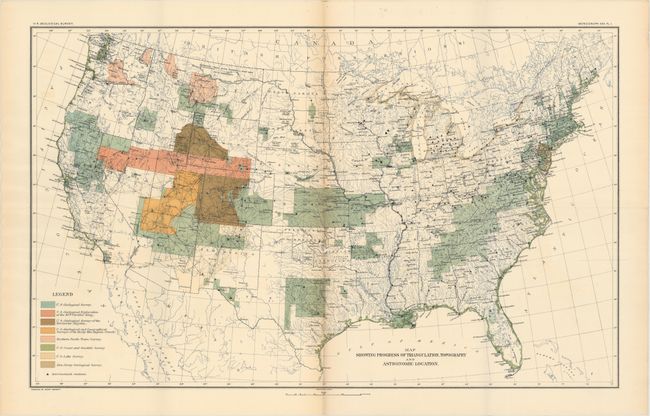
A.Map Showing Progress of Triangulation, Topography and Astronomic Location, circa 1893, printed color (28.3 x 17.4"). Very detailed and finely colored map showing survey progress throughout the United States. Colored legend locates the surveys by the U.S. Geological Survey, U.S. Geological Exploration (King), U.S. Geological Survey of the Territories (Hayden), U.S. Geological and Geographical Surveys of the Rocky Mtn. Region (Powell), the Northern Pacific Trans Survey, U.S. Coast and Geodetic Survey, U.S. Lake Survey, and the New Jersey Geological Survey. Also locates all astronomical stations. A remarkable map that summarizes the surveys completed and in progress. Condition: Issued folding with light toning along one fold and several short splits along the same fold that have been partially closed on verso with archival tape. (B)
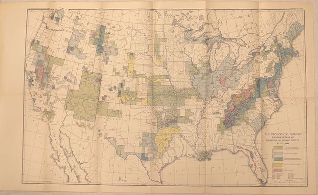
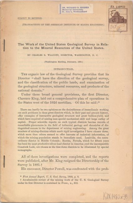
B. U.S. Geological Survey Progress Map of Topographic and Geologic Surveys 1879-1900 [with report] The Work of the United States Geological Survey in Relation to the Mineral Resources of the United States, published 1900, printed color (25.9 x 16.1"). A continuation of the surveying efforts identifying the type of survey work and mineral deposits. Still attached to a 24-page report concerning the mineral resources of the United States, published for the American Institute of Mining Engineers. Condition: Issued folding with an ex-library stamp on the front cover of the report. (A)
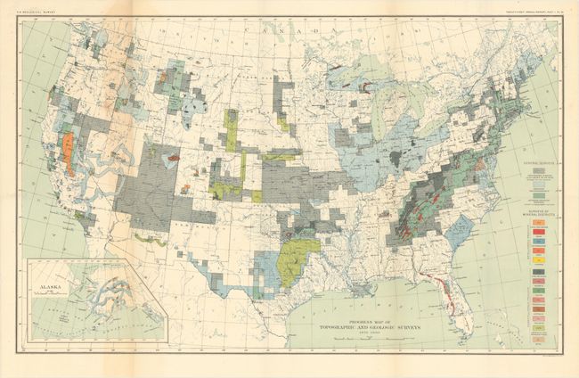
C. Progress Map of Topographic and Geologic Surveys 1879-1900, circa 1901, printed color (28.1 x 17.5"). This impressive and vivid map shows the extent of surveying work in the United States at the turn of the century including topographic surveys, geologic reconnaissance, and detailed geologic surveys. A color coded key at bottom identifies thirteen different mineral districts. Published in the 21st Annual Report. Condition: Issued folding with light toning along one fold. (B+)
References:
Condition:
See descriptions above.