Subject: St. Lawrence River, Canada
Period: 1757-64 (circa)
Publication:
Color: Hand Color
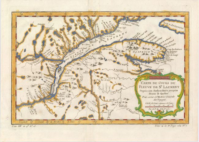
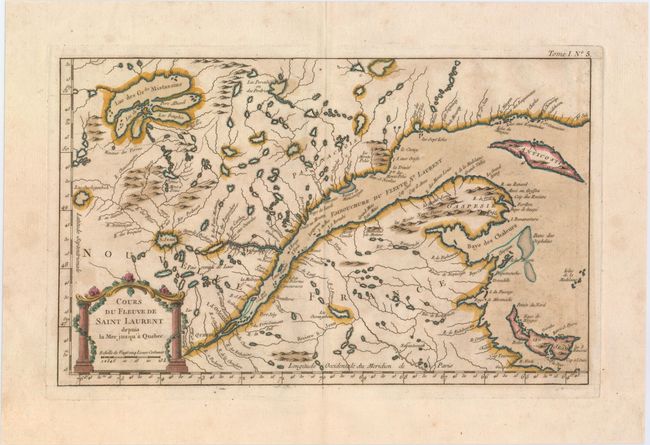
Two fascinating maps by Bellin detailing the course of the St. Lawrence River from Anticosti Island and the mouth west to beyond Quebec. Both show many rocks and shoals in the river as well as numerous villages and forts lining the shore. The first is a nice example of the second state, published circa 1780-86. It is decorated with a rococo-style cartouche that includes a distance scale. The second, larger map stretches farther north to show Lake Mistassini, Quebec's largest natural lake, and also includes a decorative title cartouche with the title and distance scale enclosed by elegant columns wrapped in flora.
A. Carte du Cours du Fleuve de St. Laurent Depuis son Embouchure Jusqu'au Dessus de Quebec..., from La Harpe's L'Histoire Generale des Voyages, dated 1757 (12.0 x 7.6"). Condition: A nice impression on watermarked paper. (A)
B. Cours du Fleuve de Saint Laurent Depuis la Mer Jusqu'a Quebec, from Le Petit Atlas Maritime..., circa 1764 (13.8 x 8.5"). Condition: On watermarked paper with scattered foxing and a few tiny spots. (B+)
References: Kershaw #627 & #660.
Condition:
See description above.