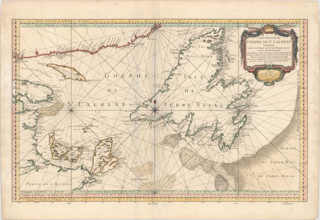
Subject: St. Lawrence Bay, Canada
Period: 1754 (dated)
Publication: L'Hydrographie Francoise…
Color: Hand Color
Size:
33.4 x 20.8 inches
84.8 x 52.8 cm
This large-scale, copper engraved map shows St. Lawrence Bay with Anticosti Island, Prince Edward Island (Isle St Jean), Cape Breton Island (Isle Royale), Newfoundland and the adjacent mainland. Numerous place names are identified along the coastlines, and a few topographical details are shown inland. The waters are filled with soundings, anchorages, rocks, and shoals, and the fishing banks are delineated, including the Banc aux Balaines (whale bank). The map is adorned with a decorative rococo-style cartouche. This is the second state, with fewer rhumb lines than the first state, and Bellin's imprint in the title cartouche, which was removed in later states.
References: Kershaw #584.
Condition: B+
A nice impression on watermarked paper with minor toning along the centerfold and several professionally repaired centerfold separations.