Subject: Eastern Canada
Period: 1850 (circa)
Publication: Illustrated Atlas and Modern History of the World
Color: Hand Color
Size:
13.4 x 10.1 inches
34 x 25.7 cm
The maps from The Illustrated Atlas were first published in serial form to a target audience that led insular lives due to the expense and hardship of travel. All that changed as the progress of the nineteenth century brought swift and dramatic changes in public awareness of far away places. Tallis' maps no doubt played an important role in this dramatic awakening. These maps not only provided up-to-date geographical knowledge, but also used vignette views within the map's design to show the native people and their occupations, cities and points of interest. The maps hark back to a cartographic tradition from the Dutch mapmakers of the seventeenth century with finely engraved decorative borders. The maps were drawn and engraved by John Rapkin with views drawn and engraved by a number of prominent artists. The maps were issued as a complete volume from 1851 until about 1865. Some of the maps were also published in other history books published by Tallis including British Colonies and, without the vignettes, in geographical dictionaries and encyclopedias until about 1880.
Size varies slightly.
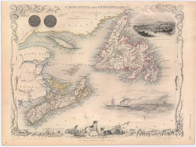
A. Nova Scotia and Newfoundland. A lovely engraved map of Nova Scotia and Newfoundland, including parts of New Brunswick and Labrador. The map includes vignettes of Halifax, steam and sailing ships in the Cod Fishery off Newfoundland, and the seals of both provinces. The decorative border features ice and fish caught on fishing lines. Map drawn and engraved by J. Rapkin, illustrations drawn by A. Fussell and engraved by J. Rogers.
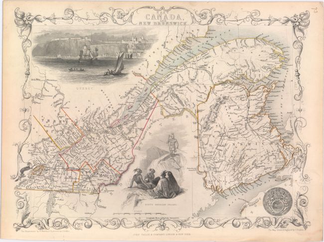
B. East Canada, and New Brunswick. Lovely nineteenth century map of the St. Lawrence River and New Brunswick, including Montreal and Quebec. A great vignette depicts Quebec as seen from the river with numerous sailing ships and boats in the foreground and the cliffs and settlement high above. In a second vignette, a group of North American Indians holds a war council. Further embellished with the seal of Great Britain and a decorative border. Map drawn and engraved by J. Rapkin, illustrations drawn by H. Warren and engraved by J.B. Allen.
References:
Condition: B+
Original outline color and light soiling primarily confined to blank margins.