Catalog Archive
Auction 146, Lot 64

"A Physical Planisphere wherein are represented all the known Lands and Seas wth. the Great Chains of Mountains wch. traverse the Globe from the North Pole. Adapted to Monsr: Buache's Memoire Read at the R. Academy of Sciences", Cole, Benjamin
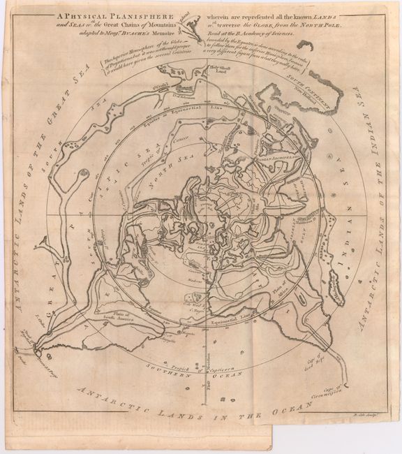
Subject: North Pole

Period: 1757 (circa)

Publication: Gentleman's Magazine

Color: Black & White

Size:
11.5 x 12.2 inches
29.2 x 31 cm
Download High Resolution Image
(or just click on image to launch the Zoom viewer)

Very unusual map projected from the North Pole to the Tropic of Capricorn within the sphere. The southernmost landmasses are then drawn outside the sphere with the "Antarctic Lands in the Ocean." The map depicts Buache's famous north polar projection showing his theory that the mountain ranges of the world are connected across the ocean basins. The map was issued (and present) in the March, 1757 Gentleman's Magazine to illustrate Buache's 3-page essay excerpted from his address to the Royal Academy of Paris.

References: Jolly #GENT-104.

Condition: B+

Issued folding with faint offsetting and a binding trim and associated small binding tear confined to the lower blank margin. Magazine is disbound with several loose pages.

Estimate: $160 - $200

Unsold

Closed on 9/4/2013

Archived