Subject: Eastern Mediterranean & Middle East, Arabia
Period: 1719 (published)
Publication: Atlas Historique…
Color: Hand Color
Size:
20.4 x 15.7 inches
51.8 x 39.9 cm
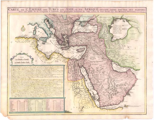
This detailed map illustrates the Ottoman Empire at the conclusion of the Great Turkish War after the empire’s loss of most of its European possessions. It covers the Balkan Peninsula through the Caspian Sea and from the coast of Algiers through the Arabian Peninsula. Major trade routes are depicted and the caravan routes to Mecca and Medina are noted in Arabia. French text describes the empire and a table of latitude and longitude provides the position of major cities.
References: Tibbetts #220.
Condition: B+
A couple of worm holes on centerfold have been repaired, none affecting the engraved image. A short fold separation in bottom right hand border has been professionally repaired. There is a bit of paper missing in the lower left blank margins, not affecting the map.