Catalog Archive
Auction 146, Lot 614

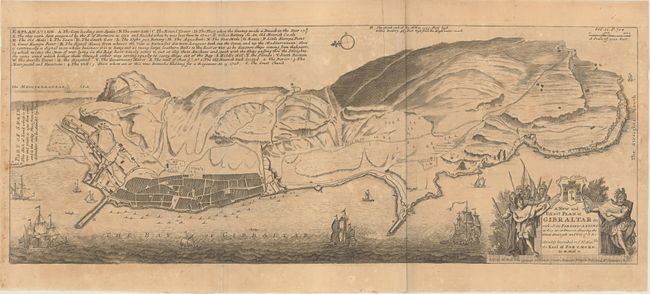
"A New and Exact Plan of Gibraltar &c with all its Fortifications as They are at Present...", Moll, Herman

Subject: Gibraltar

Period: 1745 (circa)

Publication: Modern History

Color: Black & White

Size:
23.9 x 9.1 inches
60.7 x 23.1 cm
Download High Resolution Image
(or just click on image to launch the Zoom viewer)

This is an attractive and very detailed map of the stronghold of Gibraltar. It shows the well-fortified peninsula with all its buildings, barracks, roads and batteries noted. The map is dedicated to the Earl of Portmore who was Governor of Gibraltar between 1713 to 1720, shortly after Spain ceded Gibraltar to Great Britain in the Treaty of Utrecht. North is oriented to the left. Published in London in Thomas Salmon's Modern History: or the Present State of All Nations.

References: Shirley (BL Atlases) G.SALM-1c #34.

Condition: B

Slightly uneven toning with a few extraneous creases in the image.

Estimate: $230 - $275

Sold for: $120

Closed on 9/4/2013

Archived