Subject: Northern Africa & Western Mediterranean
Period: 1708 (circa)
Publication:
Color: Hand Color
Size:
21 x 15.5 inches
53.3 x 39.4 cm
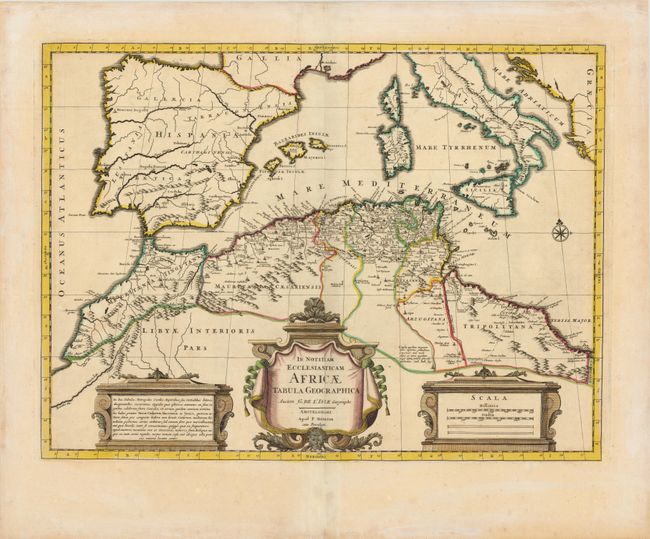
This boldly engraved map focuses on the regions controlled by the Moors in northern Africa and the Iberian Peninsula in the latter part of the medieval period. The map displays good detail along the north African coast from Morocco to Libya. It also covers the western Mediterranean with the islands of Sardinia, Corsica, Malta and the Balearics. Sicily features a smoking Mount Aetna. Three decorative cartouches and a compass rose complete the composition.
References: Norwich #297.
Condition: B
A fine impression and wide margins with a couple of faint, unobtrusive spots and a 1/2" cut adjacent to centerfold in title cartouche. There are some light stains in blank margins.