Catalog Archive
Auction 146, Lot 61

"Regiones Hyperboreae", Hondius/Bertius
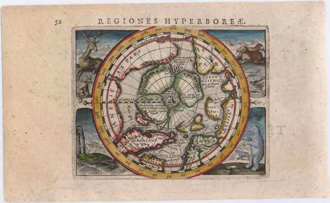
Subject: North Pole

Period: 1618 (published)

Publication: Tabularum Geographicarum Contractarum

Color: Hand Color

Size:
4.8 x 4.1 inches
12.2 x 10.4 cm
Download High Resolution Image
(or just click on image to launch the Zoom viewer)

This captivating miniature map of the North Pole is based on Gerard Mercator's map published in 1595. It depicts the region between the pole and the Arctic Circle with both the North Pole and the magnetic pole shown as rocky islands. The pole is surrounded by 'in-drawing seas' between four huge islands. Four scenes of Arctic wildlife fill the corners of the engraving, including a reindeer, fox, walrus, whale, and polar bears. Latin title page on verso.

References: Burden #184; King (2nd ed.) pp. 96-99.

Condition: A

Watermarked paper with attractive color.

Estimate: $500 - $650

Sold for: $375

Closed on 9/4/2013

Archived