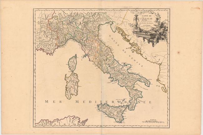
Subject: Italy
Period: 1756 (dated)
Publication: Atlas Universel
Color: Hand Color
Size:
21.3 x 18.8 inches
54.1 x 47.8 cm
This large, finely engraved map details the postal routes of Italy and Sicily. It includes towns, mountains, rivers, lakes and a host of other details. Elisabeth Haussard engraved the title cartouche, which is festooned with the regalia of the papacy.
Early maps rarely depicted roads and it was not until the middle of the 18th century that it became common for roads to be depicted cartographically. Increased road traffic and the development of formal postal systems spurred the production of maps that depicted roads. One specialized type of map that appeared in the 18th century consisted of highly detailed "post road maps." These maps showed incredible detail of the roads, stations (or stages), and the distances between them, as well as services available on the postal routes. Though many road maps were issued in the mail coach era, most were issued folded and they had a high rate of attrition due to hard use. The postal route maps issued in atlas format were less common at the time of publication, but are generally the ones that survive today.
References: Pedley #327.
Condition: B+
Fine original outline color, a sharp impression, and wide original margins with some faint offsetting and light foxing in the blank margins. There is a child’s ink notation in the title cartouche.