Subject: Italy
Period: 1680 (circa)
Publication:
Color: Hand Color
Size:
22.3 x 19.4 inches
56.6 x 49.3 cm
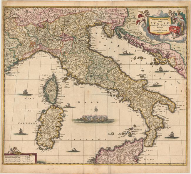
This fine map of Italy extends to include Corsica and Sardinia in the west and through the Dalmatian coast in the east, which was controlled by the Republic of Venice. The map is filled with information on the cities and towns and is beautifully ornamented with putti and Europa in the title cartouche and sailing ships and a raging sea battle filling the seas.
References:
Condition: B
Watermarked paper with lovely original color that has been partially refreshed, light soiling, and a professionally repaired centerfold separation that enters 1/4" into map at bottom. There are faint damp stains at right and left that enter 1" to 2" into map towards the top. The resulting paper weakness has been professionally reinforced, with several chips and small holes repaired and a small amount of map border in facsimile and just one area of image loss (1/4") in top left corner of map.