Subject: Central Europe
Period: 1744-60 (circa)
Publication:
Color: Black & White
Three detailed maps of Poland and the surrounding region including:
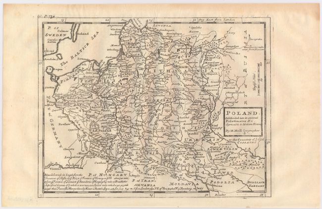
A. Poland. Subdivided Into Its Several Palatinates &c. Agreeable to Modern History, by Herman Moll, published 1744, (10.3 x 8.0"). Copper engraved map of Poland and the Baltic states extending as far north as Riga, Latvia, including excellent detail of roads, major cities and towns. A long note at the bottom provides the lengths of Poland's frontiers and the location of Warsaw in relation to London, Paris, and St. Petersburg. Published in London in Thomas Salmon's Modern History: or the Present State of All Nations. Condition: A slightly uneven impression with light toning along the top edge of the sheet, away from the image.
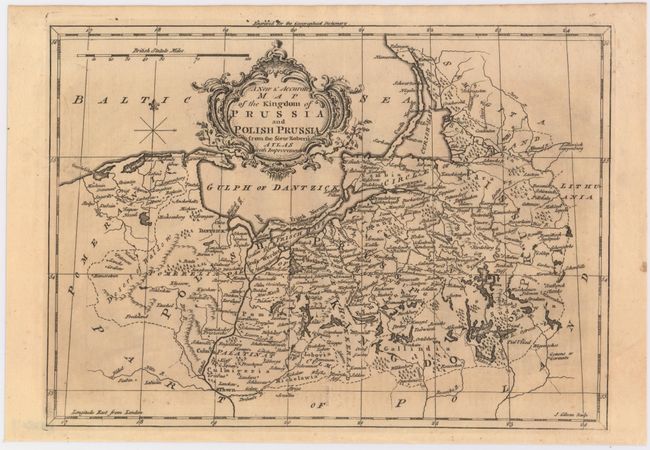
B. A New & Accurate Map of the Kingdom of Prussia and Polish Prussia from the Sieur Robert's Atlas with Improvements, by John Gibson, circa 1760, (11.8 x 8.5"). Covers the area from Pomerania east to Lithuania. Shows numerous place names, rivers and topography. Decorated by a fancy title cartouche. Condition: Light toning.
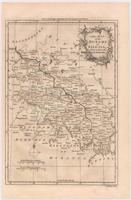
C. A New Map of the Dutchy of Silesia, Drawn from the Best Authorities, by G. Rollos, circa 1760, (7.8 x 11.3"). This fine small map covers the area of Silesia, in current day Poland, Germany and the Czech Republic. The Oder river is well depicted at center and numerous place names are identified. Condition: A hint of toning.
References: Shirley (BL Atlases) G.SALM-1c #20.
Condition: B+
See descriptions above.