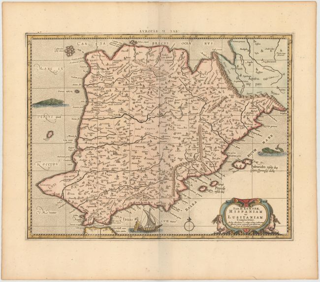
Subject: Spain & Portugal
Period: 1698 (circa)
Publication: Claudii Ptolemaei's Atlas Tabulae Geographicae Orbis Terrarum
Color: Hand Color
Size:
16.9 x 13.1 inches
42.9 x 33.3 cm
An attractive Ptolemaic map of the Iberian Peninsula. Mercator originally published this map in his 1578 edition of Ptolemy's great Geography. Although he is most renowned today for the projection he popularized and for first using the term Atlas for a collection of maps, he devoted much of his life to his Ptolemaic maps. The maps were beautifully engraved as nearly as possible to their original form and embellished with fine cartouches. This one is flanked with two bare-breasted sphinxes, and the sea is adorned with a ship and a pair of sea monsters, one of whom looks like a dog with fur and floppy ears.
References: Mickwitz & Miekkavaara #234-20.
Condition: A
A nice impression on watermarked paper with wide, original margins.