Subject: Ireland
Period: 1690 (circa)
Publication: History of Ireland
Color: Black & White
Size:
22 x 19 inches
55.9 x 48.3 cm
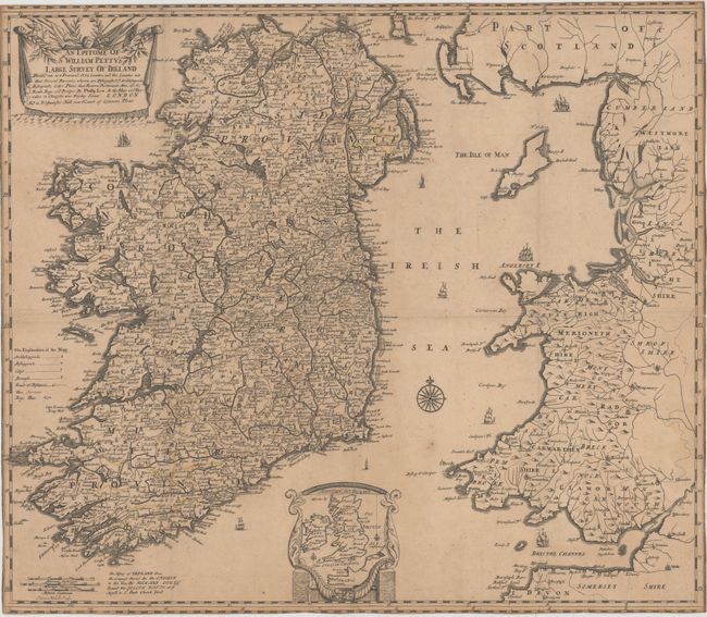
Handsome map of Ireland, showing the country divided into its 4 provinces and 32 counties. A key identifies archbishoprics, bishoprics, cities, boroughs, roads, and bogs. This map is based on a survey of Ireland carried out by Sir William Petty in 1655 and 1656. After the Irish Confederate Wars, the Act for the Settlement of Ireland provided for the confiscation and re-distribution of land by the English Parliament, which first required an accurate survey of the country. An inset at bottom center shows Ireland in relation to Great Britain as a whole. Engraved by Sutton Nicholls and published in London by Joseph Watts for Richard Cox's Hibernia Anglicana, or, the History of Ireland.
References:
Condition: C+
Issued folding, now pressed with even toning, some minor soiling, and three tiny holes at fold intersections. Fold separations in bottom and right margins that just enter map image have been closed with archival tape, and all margins have been trimmed to neatline, with minor loss of neatline in some areas.