Subject: Southern Scotland
Period: 1654 (circa)
Publication: Theatrum Orbis Terrarum sive Atlas Novus
Color: Hand Color
Size:
21 x 16.8 inches
53.3 x 42.7 cm
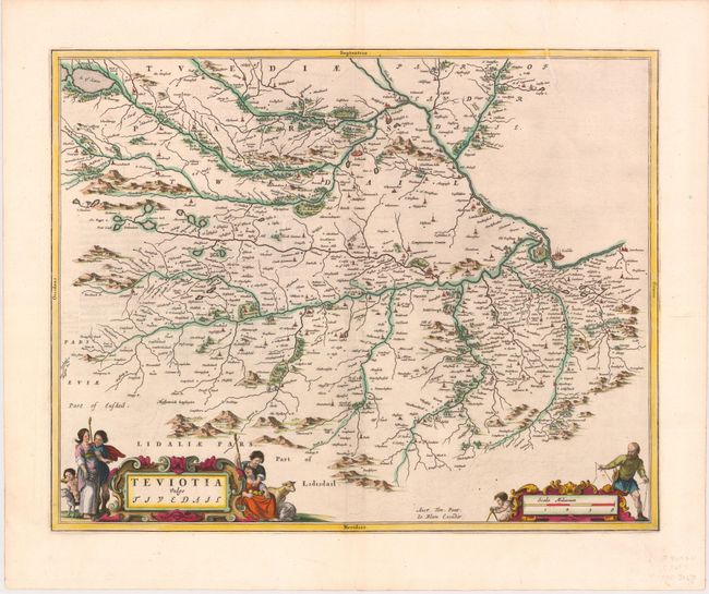
This finely engraved map depicts the historic region of Teviotdale, now near the county of Roxburghshire. The map, based on the work of Timothy Pont, famous surveyor of Scotland in the late sixteenth century, includes great detail of the rivers, cities, villages and castles. Major cities such as Jedburg, Selkirk, and Kelso are identified. An elaborate title cartouche and scale of miles cartouche decorate the map, both illustrated with regional figures. Latin text on verso.
References: Phillips (Atlases) 5941, v.5 #4.
Condition: B+
A nice impression with attractive color and light offsetting. One tear in top margin entering 2" into map image has been professionally repaired. Two centerfold separations in the blank margins have been backed in archival tape.