Catalog Archive
Auction 146, Lot 423

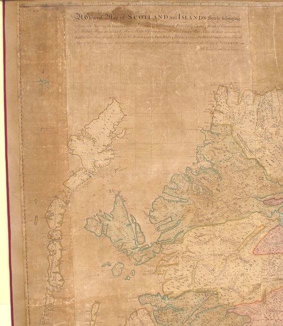
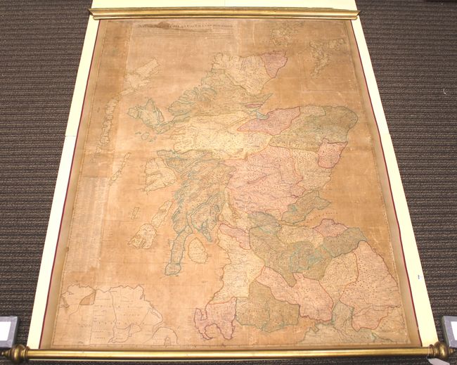
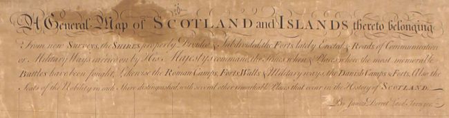
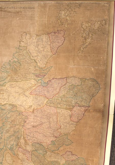
Landmark Map of Scotland

"A General Map of Scotland and Islands Thereto Belonging from New Surveys, the Shires Properly Divided & Subdivided, the Forts Lately Erected & Roads of Communication or Military Ways Carried on by His Majesty's Command...",
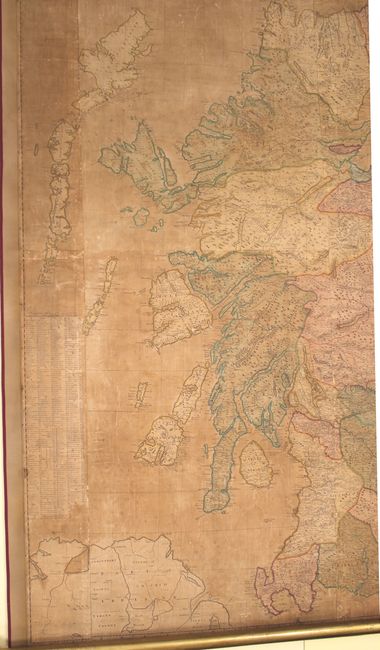
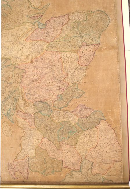
Subject: Scotland

Period: 1750 (circa)

Publication:

Color: Hand Color

Size:
52.4 x 69.5 inches
133.1 x 176.5 cm
Download High Resolution Image
(or just click on image to launch the Zoom viewer)

Produced by James Dorret, this is a landmark map of Scotland as it was the first to depict the general outline of the country correctly. This map would be the basis for others for the next 40 years until John Ainslie published a map with updated surveys of the west coast in 1789. Cartographically, the map is filled with information including battle sites, Roman and Danish forts and camps, place names, rivers and topography. Hadrian's wall is identified near the bottom of the map. Includes an inset of the Shetland Islands at top, and an index to place names at left. Joined on six sheets.

References: Moir, p. 188.

Condition: C

Original color. The map is heavily toned with numerous creases in the image, a few short tears, and several small damp stains. Remargined an all sides with parts of border professionally replaced in facsimile. Backed with modern linen with ribbon along the edges. Attached to wooden rollers with a chip at far right on top roller.

Estimate: $500 - $700

Sold for: $375

Closed on 9/4/2013

Archived