Catalog Archive
Auction 146, Lot 418

"A Modern Map of the Post Roads of England and Wales, with Part of Scotland...", Sayer, Robert

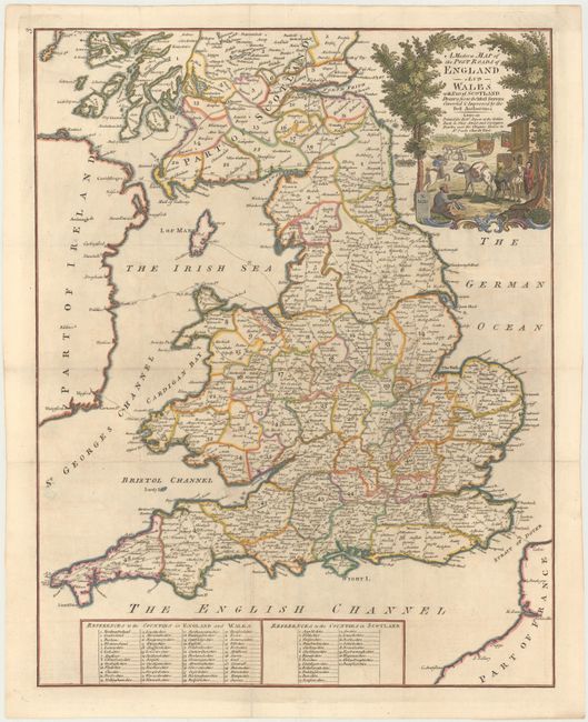
Subject: England, Wales and Southern Scotland

Period: 1757 (circa)

Publication:

Color: Hand Color

Size:
16.1 x 20.4 inches
40.9 x 51.8 cm
Download High Resolution Image
(or just click on image to launch the Zoom viewer)

This handsome map of England and Wales extends north into Scotland just past Dundee. The numerous postal roads throughout the land are shown, with distances between towns noted. Each of the counties are delineated and numbered, identified with a key at bottom. Several postal sea routes to cities in Ireland are also shown, including Dublin, Wexford, and Carrickfergus. The map is adorned with a decorative title cartouche featuring postal deliveries on horseback. Published by Robert Sayer and Carrington Bowles.

References:

Condition: B+

Issued folding, now pressed with minor offsetting and a few small spots.

Estimate: $400 - $475

Sold for: $200

Closed on 9/4/2013

Archived