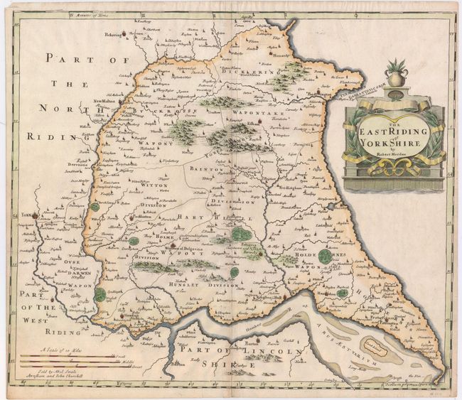
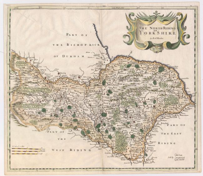
Subject: Northern England
Period: 1695 (circa)
Publication: Camden's Britannia
Color: Hand Color
Size:
16.6 x 14.2 inches
42.2 x 36.1 cm
This matched pair of maps depict two of the three historic subdivisions of Yorkshire. They are filled with interesting detail including topography, parks, roads, forests, towns and villages, and rivers. Each is adorned with a decorative title cartouche. Sold by Abel Swale, Awnsham & John Churchil. Size varies slightly.
Morden was one of the first English cartographers to show longitudes measured from the meridian of St. Paul's Cathedral (shown in degrees at the bottom of the map) and time in minutes measured locally from the sun (shown at the top). The roads on his maps are based on Ogilby's earlier survey. The Britannia was first published by historian William Camden (1551-1623) in 1586. After the publication of the final edition of Britannia in 1637, the work was not published again until 1695 when Gibson revised and translated the text from the original Latin and included fifty maps, mostly of the English counties, prepared by Robert Morden, replacing the outdated maps of Christopher Saxton.
References: Shirley (BL Atlases) T.CAMD-5a.
Condition: B+
Watermarked paper with attractive color and a few printer's creases. Both have archivally repaired centerfold separations that enter less than 1" into maps at bottom. The "East Riding" sheet has minor toning along centerfold.