Subject: North Atlantic, Eastern United States
Period: 1789 (circa)
Publication: American Museum
Color: Black & White
Size:
8.1 x 7.4 inches
20.6 x 18.8 cm
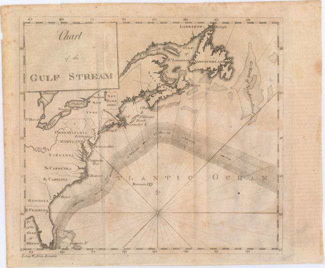
This updated plate of Benjamin Franklin's groundbreaking chart of the Gulf Stream includes a more precise depiction of the North American coastline than the 1786 version. Originally published in American Museum/Universal Magazine along with an article, "Remarks upon the Navigation," the chart was intended to spur sea captains to alter their routes for quicker, more convenient travel. It took the skeptical British years to follow Franklin's advice, but once they did their transatlantic journeys were about two weeks shorter. The Gulf Stream is shown here with directional arrows flowing through it and notes reading "4 Minutes", "3 1/2 Minutes", and so on. Although it was founded in 1777 as a republic, Vermont is not identified here; it would become a state two years after the map was published. The 1789 plate does not include Franklin's article on the same sheet or the "Annual Passage of the Herrings" inset.
References: Wheat & Brun #723.
Condition: B+
Issued folding with light toning and minor stains. There are a couple small fold separations at top and a few minute chips along the sheet's edges, none of which affect the image.