Subject: Guyana, Suriname, French Guiana
Period: 1760 (dated)
Publication:
Color: Black & White
Size:
34.1 x 22 inches
86.6 x 55.9 cm
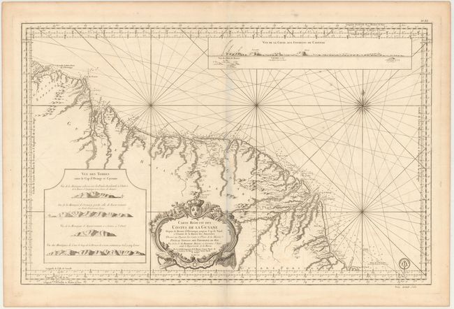
This magnificent, large-scale map of the coast of Guyana covers the region from the mouth of the Orinoco to Cabo Norte with the regions noted as being Spanish, Dutch, French and Portuguese possessions. The detail extends to include a good portion of the major rivers with the locations of forts, missions, colonial settlements, and Indian villages. Inset at top is a coastal approach view of Cayenne and inset at lower left are four other coastal views of the entrance to Cabo Orange and Cayenne. In addition to the informational nature of the chart, it is ornamented with a fine compass rose and decorative title cartouche. The engraved seal of the Depot de la Marine is at bottom right, with the price Prix Trente Sols just below the neatline.
References:
Condition: B+
Heavy paper with large watermarks dated "1782." There is light offsetting and a few tiny spots.