Subject: South America
Period: 1783 (dated)
Publication: Universal Atlas…
Color: Hand Color
Size:
14.4 x 14.6 inches
36.6 x 37.1 cm
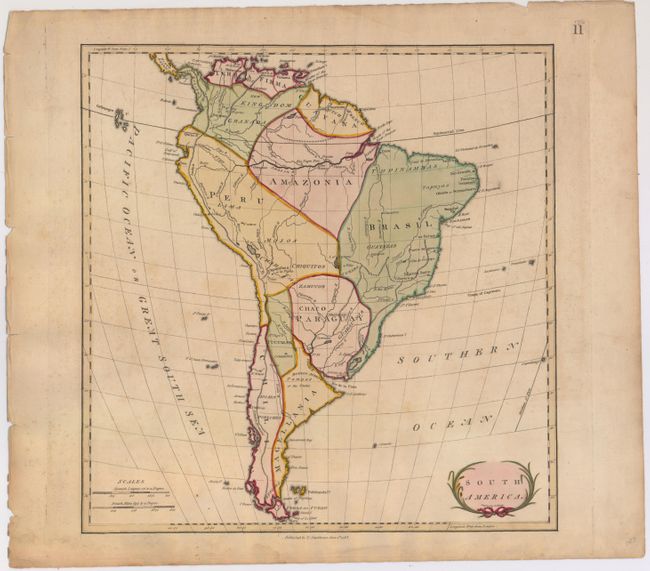
This map of the continent shows limited detail of rivers and mountains and is divided into just ten regions: Magellania, Chili, Peru, Tucuman, Paraguay, Brasil, Maazonia, Guayana, Kingdom of Granada, and Terra Firma. The Amazon River extends to the Andes but shows only limited tributaries. Includes the Galapagos Isles, the Falklands, the Strait of Magellan, and part of Central America. Small floral-themed title cartouche at lower right. Maps by Stackhouse are uncommon. Engraved by S.J. Neele.
References:
Condition: B+
Original color on watermarked paper with a tear that just touches neatline at bottom and has been closed on verso with archival tape. There is also some minor soiling and some damp stains not affecting image.