Subject: South America
Period: 1716 (dated)
Publication:
Color: Black & White
Size:
25.2 x 18.8 inches
64 x 47.8 cm
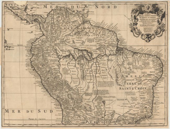
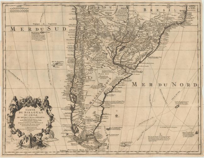
Fabulous matched pair of boldly engraved maps that together cover the continent. Joined size would be 22.5" x 38". It is unusual to find these maps together.
The northern sheet is filled with information and notations speculating about the Indian tribes and the tributaries of the Amazon. The capitaineries are shown along the coast of Brazil. A notation in Guyana notes the mythical Lac de Parime on which the golden city of Manoa del Dorado was supposed to be located. The central part of the map (Pays des Amazones) is filled with Indian names. The Inca Way (Grand chemin des Ingas) is shown from Chuquisaca in Peru to Pasto in Colombia. The title cartouche features mythical Amazon warriors, a pot of gold and King Louis XIV, as the Sun King.
The southern sheet is filled with great topographical detail and notations throughout. The tracks of Magellan, Sarmiento, Brower, Beauchesne, Sharp, Sr. de la Roche, Halley and Vespucci are marked, and Amerigo Vespucci's ship is shown sailing in the Atlantic. The title cartouche features the Notus (the south wind) and Native American figures.
References:
Condition: B
Issued folding, with dark impressions, a few tiny holes at fold intersections, and light soiling. The northern sheet has a small chip at top left with some loss of border and the word "Mexique," which has been repaired with old paper.