Catalog Archive
Auction 146, Lot 28

One of the Earliest Thematic World Maps

"Die Ebbe und Fluth auff einer Flachen Landt-Karten Furgestelt", Happel, Everard Werner
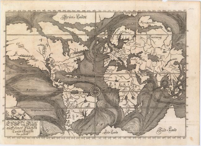
Subject: World

Period: 1687 (circa)

Publication: Relationes Curiousae…

Color: Black & White

Size:
11.4 x 8 inches
29 x 20.3 cm
Download High Resolution Image
(or just click on image to launch the Zoom viewer)

This is one of the earliest thematic maps of the world. The ocean currents are graphically depicted and although conjectural, the map is the first serious attempt to portray scientific phenomena based on the reported findings of seaman. Four curious tracks, perhaps denoting subterranean tunnels, link the Black and Caspian Seas, the Caspian Sea with the Persian Gulf, the Mediterranean with the Red Sea, and most interestingly the Atlantic with the Pacific through the Isthmus of Panama. The landmasses are marked with the locations of live volcanoes. Noted as scarce by Shirley.

References: Shirley #468; Robinson, p. 46-47.

Condition: B+

Issued folding with minor soiling and a long printer's crease running along the bottom of the image.

Estimate: $1,200 - $1,500

Unsold

Closed on 9/4/2013

Archived