Subject: Southwestern United States & Mexico
Period: 1846-65 (circa)
Publication:
Color: Hand Color
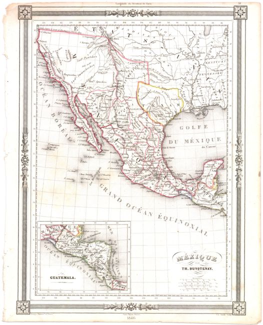
A. Mexique, by Thunot Duvotenay, dated 1846 (9.0 x 12.0"). This map is centered on Mexico and the Southwest showing the Republic of Texas. It contains pre-Mexican/American War geography apart from the addition of a dashed line denoting the new territorial limits of the United States. The inset "Guatemala" shows most of Central America through Costa Rica, all labeled Guatemala. The region along the California coast is called Nouvelle Californie and the Baja is Ancienne Californie. This map is dated 1846, but the geography shown is a few years earlier. Condition: There are a few faint spots in the Pacific Ocean and a light damp stain in the upper border.
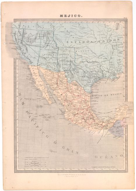
B. Mejico, by Turgis, circa 1865 (10.7 x 14.3"). This map is focused on Mexico with political delineations depicted. It extends to include a good portion of the Southwest, displaying Arizona, New Mexico, and Utah territories along with California, Texas, and the new state of Nevada. Place names, Indian tribes, rivers, lakes and topography are shown. Condition: There is very minor soiling in image, binding holes in the left side margin, and a pin hole just below the bottom neatline.
References:
Condition: B+
See descriptions above.