Subject: United States, Texas & Mexico
Period: 1846 (dated)
Publication: Universal Atlas
Color: Hand Color
Size:
15 x 12 inches
38.1 x 30.5 cm
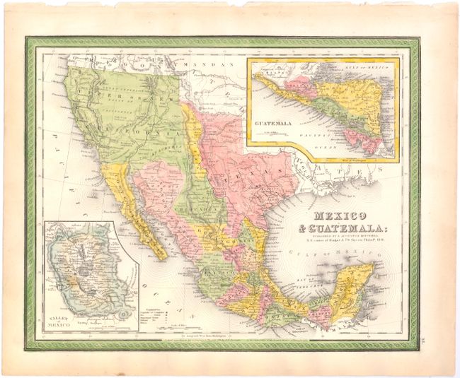
This uncommon map was registered by H.N. Burroughs in 1846 and was published by Mitchell the same year. The map still shows Texas as an Independent Republic. New Mexico is shown as a small sliver of land between Texas and Upper California, extending north into the western part of present day Colorado. Santa Fe and Taos are in Texas. Upper or New California occupies much of the West, extending into today's western Colorado. The American West extends to the Pacific with Oregon Territory named. Austin appears prominently in Texas as the capitol city, along with Austin's Grant, Houston, Goliad, Loredo, Washington, Bexar, and several other early settlements. Many Indian tribes are named and located. In its transitional geography, Fremont's Pass is shown and the discoveries of Fremont in the Great Basin region are current, not what we've seen on some other examples of this map also dated 1846. The Pueblo de Los Angeles was missing on earlier examples, but is included here. The missions of California are located and named. Large insets show Guatemala and the Valley of Mexico. Blank verso.
References:
Condition: B+
Original color with one spot in the Valley of Mexico inset and light toning along sheet edges.