Subject: Texas
Period: 1879 (dated)
Publication:
Color: Hand Color
Size:
25.5 x 19.3 inches
64.8 x 49 cm
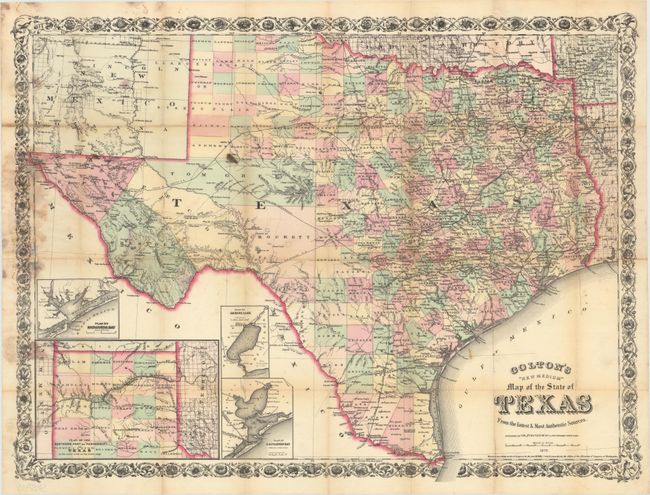
This rare pocket map of Texas presents extensive detail throughout the settled part of the state. While much of the western portion of the state is sparsely settled (El Paso, Presidio, Pecos), full county development has taken place in the panhandle, replacing Young Territory. The map shows excellent detail of the expanding railroad network, forts, roads, watershed and topography. Includes insets of Plan of Matagorda Bay, Plan of Sabine Lake, Plan of Galveston Bay, and Plan of the Northern Part or "Panhandle" of Texas. Taliaferro lists the map with the same copyright date, but dated 1877. Decorated by a fancy title and scroll border. Covers are not present.
References: cf. Taliaferro (Rosenberg) #362.
Condition: C+
Issued folding on thin banknote style paper with mildew stains on the left side of the image, several small splits at fold intersections, and light toning along a few folds. There are some light pencil notations and a few spots in the image.