Catalog Archive
Auction 146, Lot 237

"Map of the State of New York", Thomas and Andrews
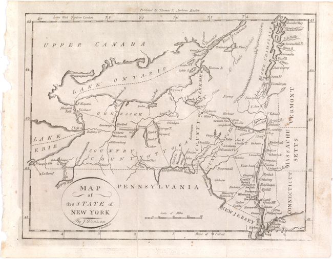
Subject: New York

Period: 1796 (published)

Publication: Morse's Universal Geography

Color: Black & White

Size:
9.5 x 7.4 inches
24.1 x 18.8 cm
Download High Resolution Image
(or just click on image to launch the Zoom viewer)

This early map of the state of New York shows watershed and topography, and names towns and counties. In the lower portion of the state there is an area marked Ceded to Massachusetts. Chautauqua Lake appears as Calaughaque L. Meridians are from both London and Philadelphia. Drawn by J. Denison, engraved by Amos Doolittle and published by Thomas & Andrews, Boston.

References: Wheat & Brun #368.

Condition: B+

Issued folding and now flattened with a 2.2" fold separation that has been repaired on verso with archival material. Minor foxing.

Estimate: $150 - $200

Unsold

Closed on 9/4/2013

Archived