Subject: Boston, Massachusetts
Period: 1874 (dated)
Publication:
Color: Hand Color
Size:
20.8 x 13.3 inches
52.8 x 33.8 cm
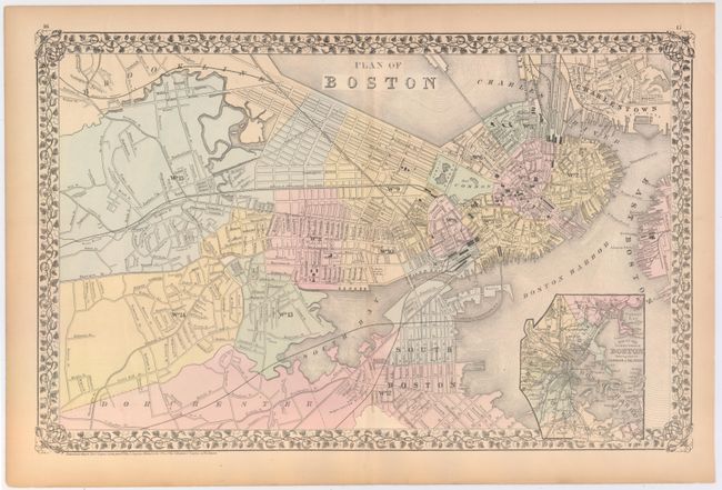
This is the larger plan by Mitchell. The proposed landfill of the Back Bay shown on earlier maps appears to be complete. Developer Uriah Cotting built a land dam under the extended Beacon Street that trapped water in the Back Bay, preventing sewage from escaping. The states answer was to completely fill in the Back Bay. This chart shows the corrective work completed after more than two decades. Includes a large inset "Map of the Country around Boston showing also its Harbor & Islands".
References:
Condition: B
There is an archivally repaired centerfold separation at top that extends 1.5" into the image, light toning along the edges of the sheet, and a few edge tears confined to the blank margins.