Subject: Santa Clara, California
Period: 1914 (dated)
Publication:
Color: Printed Color
Size:
26 x 19 inches
66 x 48.3 cm
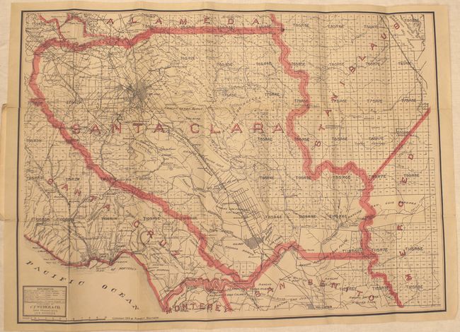
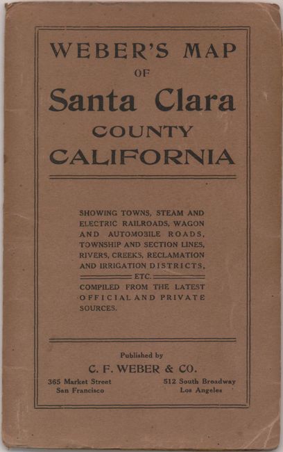
Detailed pocket map of the area with much information regarding infrastructure, electrical lines, gas lines, steam railways, electric railways, wagon roads, trails, reclamation districts and irrigation canals. The map extends from Redwood in the northwest to Hollister. It shows each town in street grid plan, locating San Jose, Gilroy, Menlo Park, Mountain View, Sunnyvale, Santa Clara, Santa Cruz, etc. No sign of Los Gatos save for a notation below Campbell "Rinconada de Los Gatos." Other details include mines, observatories, ranches and hot springs. This scarce map shows county boundaries and names in pink overprinting. Folds into brown paper wrappers with printed title. Published by C.F. Weber & Co., San Francisco and Los Angeles.
References:
Condition: B+
Several fold separations have been repaired with archival tape on verso and there is a hint of toning along a few folds. Covers are dog-eared and are partially split along the centerfold.